China's Rocket Launch Draws Tourists to Hainan Island
10
World
March 8, 2025 13:49
longlou, hainan, china - Hainan Island becomes a tourist hotspot for rocket launches, boosting space tourism and China's space ambitions.
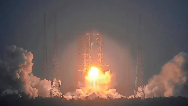
Hainan Island's Rocket Launch Attracts Tourists
Thousands flock to Longlou, Hainan, to witness rocket launches boosting China's space tourism.
National Pride on Display
Long March 8A rocket launch by China Aerospace Science and Technology Corporation (CASC) showcases China's space ambitions.
Space Tourism Boom
- Wenchang becomes a space hub attracting 'rocket chasers'.
- Increased visitors and hotel development mark Longlou's transformation into a 'space center'.
- Hotels offer space-themed accommodations and astronaut experiences.
Shifting Focus to Space Education
Wenchang aims to blend entertainment with scientific education to deepen understanding of China's space endeavors.
Unlocking Space Mysteries
China's space exploration targets unraveling universe mysteries, exploring Mars, and expanding the solar system's boundaries.