
Google Maps gets sharper images
Tech
June 28, 2016 08:33
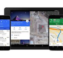
- Google Maps and Google Earth satellite images get sharper. Namely Google will use pictures created by the satellite Landsat 8. That satellite was launched in 2013 and provides more detailed pictures that also have another realistic colors.
Google made the change on Monday at Google Maps blog. To select the best pixels from millions of photos to a cloud-free world to come Google, which merged into new images.
The new satellite images are immediately available for all users of Maps and Earth.
3:39
'Mariah Carey still topper '
1:36
Do you know this trick?
1:08
Scary: hammer test for glass bridge
Leave a comment