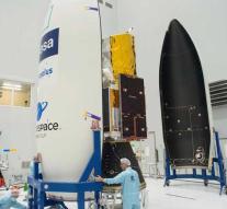
Hypermodern wind vane goes into space
kourou - The Aeolus is a hypermodern wind vane that has to go into space this Tuesday. The satellite must, from 320 kilometers altitude, chart the wind on earth. There is still relatively little known about this.
Measuring the wind is still done by weather stations on the ground, such as at the KNMI in De Bilt. Occasionally weather balloons go into the air. Aircraft indicate after landing which winds they encountered along the way. The problem is that they are all snapshots. We only know how the wind at a certain moment blows at a certain place. There is no overall picture.
How the wind blows over developed and densely populated areas such as Europe and North America is still reasonably well known, explains Martin Kaspers. The Dutchman is responsible for the proper functioning of the Aeolus within the European space agency ESA. 'But we have no idea of the winds over Africa, South America, the North Pole and the South Pole. We do not know how high the wind blows, how hard and in which direction. There are gaps in the data, 'says Kaspers. And that while we are partly in the Netherlands again.
A better image of the wind should yield better weather reports. Kaspers: 'In the long run that can make a lot of difference. When the weather changed after the recent heat wave, bad weather started. We got code orange. But only at the last moment did we know if the bad weather would cross the west or the east of the country. 'Eventually the inconvenience turned out to be too bad. 'With better data you can prevent that you unnecessarily use an alarm. Suppose the KNMI code issues yellow and nothing happens, people say it was fainting. The next time you do not do it and it turns out to be disastrous. With better data you can better anticipate. '
The measurements can also help with hurricanes like Irma and José, who last year went over Sint-Maarten. Kaspers: 'You can better predict which areas you have to evacuate. And you avoid using tools where that is not necessary. '
To measure the wind, the Aeolus laser beam sends towards the earth. The atmosphere reflects the rays. On the way the signal changes through what the beam encounters. A special computer system, designed by the KNMI, can work out which wind the jet has encountered along the way. A 'wind profile', the ESA calls it.
The satellite will turn around the earth in an hour and a half, from the North Pole to the South Pole and back again. The earth slowly passes beneath him, so that with each job another part of the planet comes into view. The entire planet was mapped in a week's time.
The mission of the Aeolus takes at least three years, but there is enough fuel on board for five years.
Leave a comment