'Dutch' windatellite into space: better predict the weather
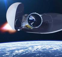
kourou - Europe will be hosting a new satellite on Wednesday. It is the Aeolus, who will have to map out exactly how the wind blows on the earth in the coming years. This is unknown in many places and that makes weather forecasts uncertain.
The launch was actually scheduled for Tuesday, but did not continue. The reason: it blew too hard.
The Aeolus is named after the ruler of the winds in ancient Greek mythology. He goes to a height of 320 kilometers and turns around the earth in one and a half hour time, from the North Pole to the South Pole and back again. The earth slowly passes beneath him, so that with each job another part of the planet comes into view. The entire planet was mapped in a week's time.
During the flight, the satellite sends laser beams to the earth. The atmosphere reflects the rays. On the way the signal changes through what the beam encounters. A special computer system can use this to calculate which winds the jet has encountered along the way.
The Netherlands is also involved in the mission. The computer system that translates the laser measurements from the satellite into wind data is made by KNMI. The solar panels that give the satellite power come from Airbus Defense and Space in Leiden, which in the past was called Dutch Space and Fokker Spaceflight.
The launch will take place from the European space base in Kourou in French Guiana. Take off is scheduled for 23. 8.09 am Dutch time. The mission will take at least three years, and possibly another two years longer.
Leave a comment